The Panama Canal
Here is a 1 minute video of our trip through the Canal taken by the Eurodam photographers. As the ship is going throught locks you can also see ships going through the brand new locks for the bigger ships.
We arrived at the Canal about 6am wth lots of ships at anchor waiting their turn to get into the canal
At about 8am we entered the canal. Our direction of travel through the canal is North to South
(not east to west)
 |
| Entering the Canal |
 |
| This branch shows where the original canal was planned and dug by the French in the 1800's |
 |
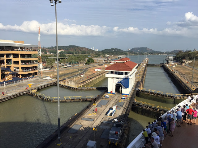
| Following the container ship into the first Gatun Lock |
 |
| Lock doors are opening for us |
 |
| Looking behind us as the loc doors close. There is a traffic bridge on top of one set of doors. (each lock has sets of doors at each end) |
 |
In this photo, you can see a fire truck crossing on the gate bridge. You can also see the rapids where they emptied water out of the lock across from us.Looking over to the side of the canal, you can see how thick the jungle is around the canal zone.An oil tanker entered the lock beside usWe were waving at the tanker and the tanker waved back. The oil tanker is lowered on it's way to the Atlantic Ship photographers at the lock Gatun Lake is seen beyond the last gates. The 3 Gatun locks raised us 85 feet. Cruising Gatun Lake
It was a beautiful day. Lot of sun and temps in the low to mid 80's.
-Very pleasant for this part of the world. There are many islands and shallow areas in the manmade lake, where they flooded the Chagres River. The lake is 26m (85 m) above sea level. All ships must follow channel markers for the 33 km. of this lake. Entering the Culebra Cut - one way traffic only. Dredging of the canal is an ongoing operation Culabra Cut - known for it's unstable geology and many landslides The Centennial Bridge Shoring up the hillside because of landslides Entering the Pedro Miguel Lock. You can see the new Pacific lock on the right, and faintly in the distance, the Bridge of the Americas. The beautiful landscape around the canal Being lowered in the Pedro Miguel lock. We are now looking up at the mule (and a very friendly driver) As we enter the final set of locks, Miraflores Locks, the rowboats come out to hook up the mule lines. This is how they have hooked up the lines since the opening of the canal. Our guide said they have tried more modern methods but the little rowboats still work the best in each lock. Miraflores Locks Frigate Bird. These birds with the beautiful tails were seen all through the canal and in the Central American ports. Skyline of a very modern looking Panama City The Bridge of the Americas - We hit the pacific at about 5:45 pm; so our transit of the canal was approximately 10 hours. Central America ports are continued in Part 2, 3 and 4 of this blog Link for part 2:Puntarenas Costa Rica to Corinto Nicaragua Link for part 3: Guatemala Link for part 4: Mexico |


No comments:
Post a Comment